


Eagle Falls Trail to Eagle Lake
DETAILS:
Location:
Eagle Falls Trailhead: 138 Emerald Bay Rd, South Lake Tahoe, CA 96150
Emerald Bay State Park Lookout: 01805102, South Lake Tahoe, CA 96150
Hours of Operation: 24/7
Parking: Limited parking available for $5 (arrive early to secure a spot). Parking at Eagle Falls Trailhead is cash-only. There is a credit card kiosk available if you park at Emerald Bay State Park Lookout parking lot just a couple hundred yards to the north.
Cost: Free!
Time Commitment: 2-3 hours.
MISC:
The trail to Upper Eagle Fall & Eagle Lake is dog friendly.
Desolation Wilderness Permit (free) is required to hike to Eagle Lake and is available near the trailhead.
Bathrooms available at Eagle Falls Trailhead & Emerald Bay State Park Lookout.

The shores of Lake Tahoe
Lake Tahoe is one of the most beautiful wonders in the entire state which means there are countless hiking options to consider when visiting… unless you’re traveling with a dog. For instance, Emerald Bay State Park, along with all California state and national parks, don’t allow dogs (except for campsites, parking lots, picnic areas & fire roads). So your options become a lot more limited in this case. Thankfully, one of the most popular, short, and scenic hikes in the entire region; Eagle Falls to Eagle Lake, allows our four-legged furry friends to join the fun and is generally a can’t-miss adventure while in the Lake Tahoe area.
Located on the west-side of Route 89, about 15 minutes from “downtown” South Lake Tahoe, you’ll find limited parking spots directly in front of the trailhead, so arrive as early as possible to secure a spot since road-side parking is far and few between.

Signage for the trailhead
My personal suggestion is to park just north of the trailhead at Emerald Bay State Park Lookout which is less than a quarter mile away. The parking lot here is (relatively) larger and allows you to kill two birds with one stone since you’ll be greeted with a magnificent view of Emerald Bay… which you were probably going to visit anyway due to its close proximity.


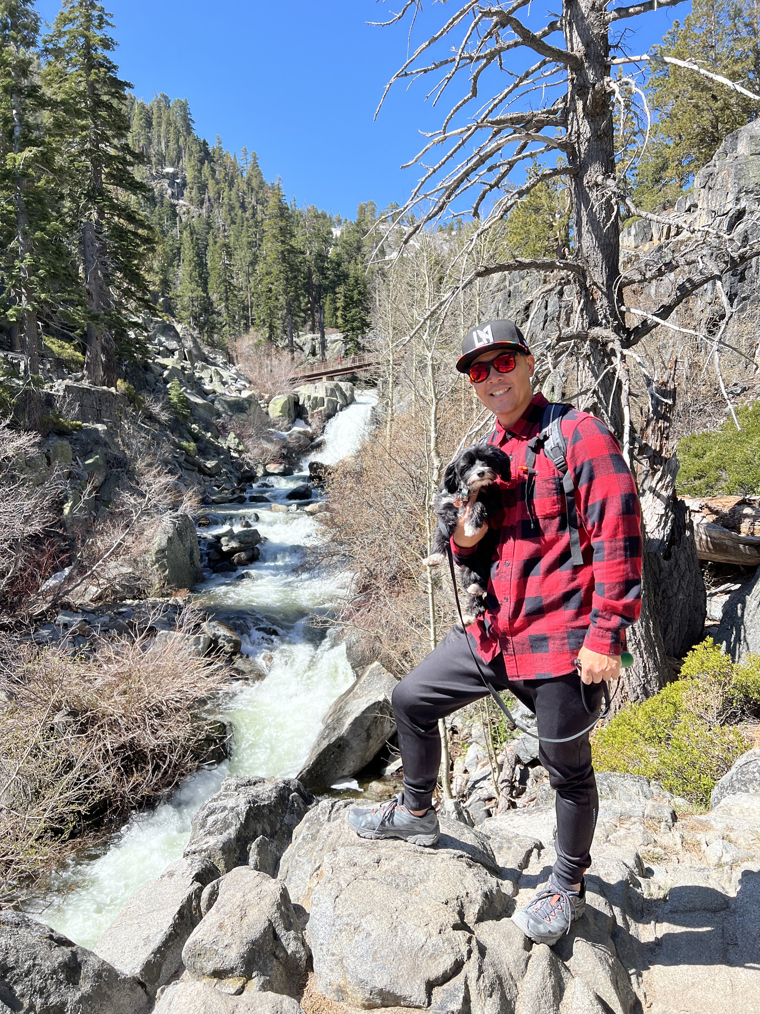
As you walk back towards the trailhead, you can actually take the short, lake-side path to see Lower Eagle Falls up-close & personal as it drops down towards the bay. Technically speaking, Eagle Falls is separated (by Route 89) into a lower section and an upper section. The trailhead will take you up to Upper Eagle Falls as you proceed to Eagle Lake. Other trails leading down to Emerald State Park will allow you to view Lower Eagle Falls from below… if you’re not traveling with a dog.
After you’re finished with Lower Eagle Falls, it’s time to proceed to the trailhead which is directly across the street. All told, the hike from the trailhead to Upper Eagle Falls and then to Eagle Lake is an out-and-back trail that is approximately 2 miles roundtrip. It’s definitely uphill the entire way to Eagle Lake and requires some easy rock-scrambling, but should still be accessible to most.
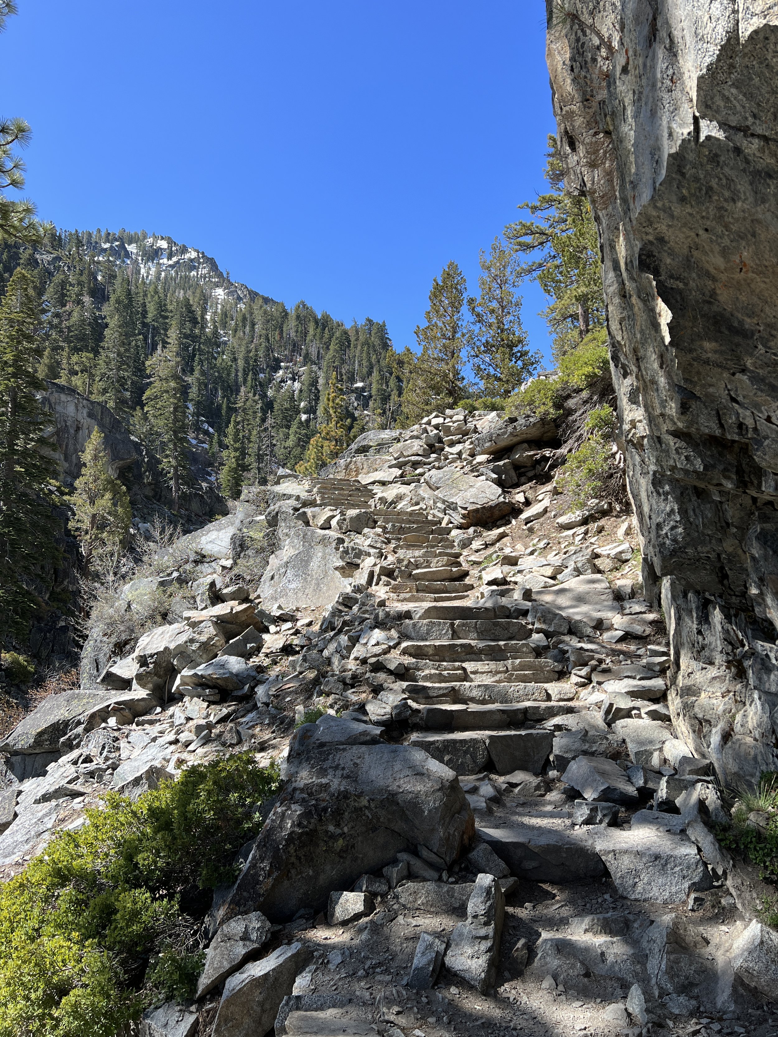
You’ll notice a map for the trail which actually loops around beginning at the trailhead. If you want to extend your hike (also visiting the vista on the north end of the loop), you can veer to the right. But if you want to proceed directly to Eagle Lake, stay on the left portion of the loop. When you begin, you’ll immediately be greeted by a series of stone steps built right into the hillside in order to reach the bridge that crosses Upper Eagle Falls above. All told, it’ll take you less than ten minutes to reach the bridge, providing amazing views of Upper Eagle Falls as you ascend.
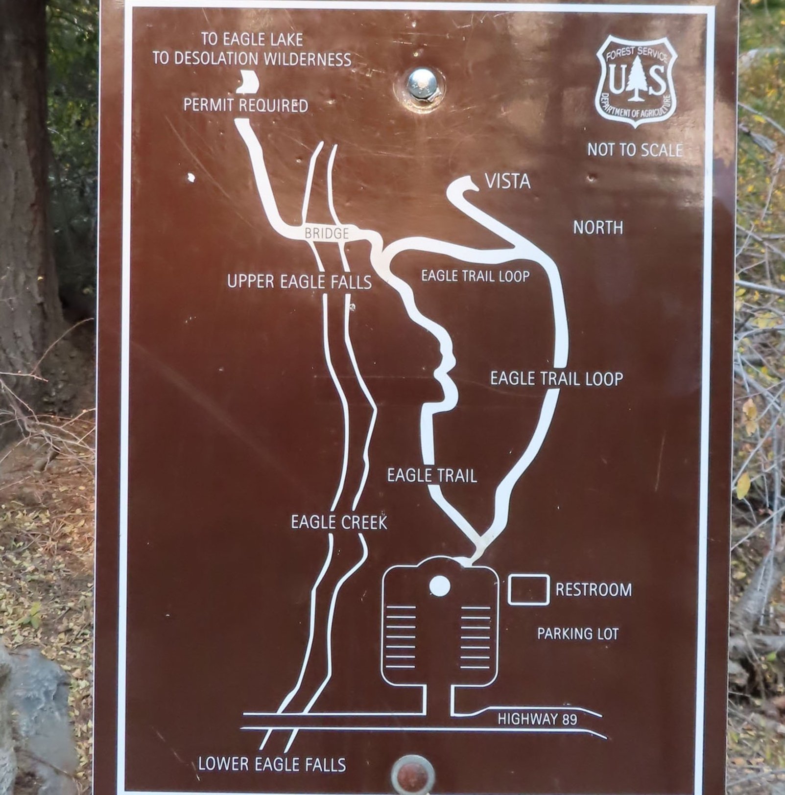
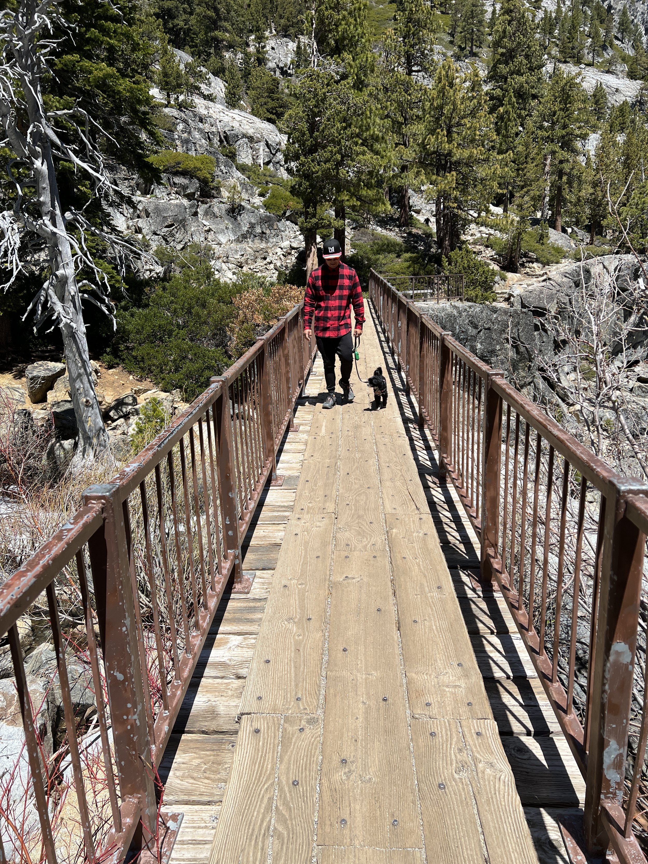
Once you reach the bridge, you can return down the way you came or via the other side of the loop if you don’t want to proceed any further, but I promise that you’ll want to keep moving forward to Eagle Lake. This is where you’ll need a (free) Desolation Wilderness Permit so make sure to fill one out at the beginning of the trail. In about another mile, you’ll reach Eagle Lake as it sits beautifully nestled in the heights of the El Dorado National Forest, majestically reflecting the Sierra Nevadas in the water. The view (along with the trek in the altitude) will surely take your breath away. After enjoying the peace and tranquility of the lake, we decided to head back, but you can advance even further along the trail in order to reach some elevated viewpoints of Eagle Lake and the surrounding area, if you’re so inclined!

Eagle Lake

